Hang on a cotton-picking minute. I did just select "unbuilt" didn't I?
You did indeed.
Well, I happen to know for a fact that the southern bit of the Manchester Outer Ring Road exists. You're clearly making it up as you go along.
Well, yes, it does. And no, I'm not.
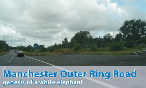
Today the former M63 through Stockport is indeed the southern section of the Manchester Outer Ring Road. However, like all good motorway ring roads, it's a bit of a bodge.
What do you mean?
Well, take a look at the eastern end of the former M63, and specifically the former M63/M66 junction, which also involves the unbuilt A6(M) as well. It's clear to see that the route of the Ring Road isn't the original idea.
Yes, that is rather obvious, isn't it. So what was the plan then?
Look around the general area, and look for something that's completely out-of-place...
I'll even give you a clue - look to the south of the present M60 - somewhere near Manchester Airport.
Just out with it!
You mean you didn't spot the A555? It's a massive dual carriageway that goes from, well, nowhere to nowhere via, well, nowhere much. This is a remnant of the original southern section of the Manchester Outer Ring Road - downgraded since those days, mind, but still huge.
The whole "missing" section would have been the A6(M) Stockport North-South Bypass, round the southern side of Hazel Grove, meeting up with the A555, and then from there onto the Manchester Airport spur from the M56. Whilst there doesn't seem to be much space there, the junction is actually designed to have the spur continue through the junction, and out the other side.
The Outer Ring Road would then have headed northwest along the edge of the urban area, through the nice straight wooded area to the west of Roundthorn Industrial Estate, along that obvious straight land between Greeba Road and Tottenham Drive, and across the football pitches. Gateacre Walk is built right along the line of the road, and it would have crossed the B5167 roughly at the Tunshill Road junction before heading right up that very convienient gap in the houses right up the M60.
Yes, I can see how that might all link up. So, what's the historical slant then?
The Manchester Outer Ring Road was first proposed way back in 1945, in the Manchester & District Regional Plan. Not a lot really happened for a while, in common with most wartime proposals, and the idea was still around by the time the SELNEC Highways Plan was published in 1962 - though there were some important differences.
In the SELNEC plan, the section to the west of M56 (known as the Western Parkway) was of the lowest priority, and initially traffic wishing to orbit Manchester would be sent via M56 - although the land for that section was to be reserved and it was fully expected that it would be eventually built. By this time, of course, the Stockport East-West Bypass (later M63) was part of the plan, and this road would eventually be the undoing of the southern section of the Outer Ring Road.
As an aside, there's quite a few documents in the National Archives that show the Ministry trying to work out the numbers of motorways in the general Manchester area. These documents show that no number was ever formally allocated to the Southern Section, though both M64 and M68 are included on the "possible" list.
In 1972, the M56 was opened between J1 and J7, and included the Airport Spur - which was still at this time planned to eventually be a part of the Outer Ring Road. Indeed, several commercially printed maps from the period actually show the Spur including a small section through the junction ready for the extension to the west. This section was, of course, never built - although central Government documentation shows that it was still very much on the cards in October 1972.
The tide was starting to turn on motorway construction at that time, and the Outer Ring Road was one of the candidates for the chop - and by 1978 the decision had been taken to hijack the Stockport East-West Bypass as part of the Outer Ring Road; but the Southern Section refused to die.
Whilst the A6(M) was in the Government's future plans throughout the 1980s, the route of the Southern Section lay dormant, but was protected from development by Cheshire County Council - which was probably quite a good idea as along came Roads For Prosperity in 1989, and suddenly the Southern Section was back on - or at least a watered down version between the Airport Spur and the A6(M) was. Construction started with almost unseemly haste on the central section in order to "tie-in" with the constuction of the A34 Wilmslow and Handforth Bypasses, meaning that the first section was pretty much useless. Then, nothing. Cancellation loomed when the money ran short, and the Southern Section was sent back to be looked at once more. Perhaps surprisingly to the Government, the recommendation came back that yes, it was probably a good idea to construct the road.
With the plan to foist blame for the cancellation elsewhere foiled, the Government cancelled it anyway, and today that white elephant of a road is still there, still barely used. Suddenly in November 2008 it rose once more, as part of the Government's plan to spend a few quid and stop a recession - though it's been awfully cagey about the standard of the road...
Meanwhile, the Western Parkway section was abandoned in the 1970s, though as with the rest of the Southern Section, its route was to be protected from development for some time, although even that lapsed, with some of the land allowed to have development built upon it. Still, there was some left and as part of the Manchester bid for the Olympic Games in 1996, a Metrolink line to Manchester Airport was proposed via Chorlton-cum-Hardy and Wythenshawe. Known as the "Olympic Link", this tram line would have followed the line of the Western Parkway, which explains why although the route is clearly visible in aerial photographs, it is no longer wide enough for a motorway, or even anything approaching a major road. The rest of the space was allowed to be sold off, and housing built right up to the edge of the proposed Metrolink line.
So what route would it have taken?
Let me show you the relevant Might Have Been Map page.
Can I comment on this motorway?
Of course! Contact me and I'll put them here!
Have any other visitors commented?
Not yet, they haven't.