Where is it?
Here, in the north of Northern Ireland, if that makes sense.
Yeah, it does.
If you're paying attention, it looks really weird on maps. There's this little bit of M2 going around the east side of Ballymena in a roughly north-south direction. If you then head south of there, you find the rest of the M2 which heads west from Belfast, blatantly in the direction of the City on the River Foyle, you know, the second largest city in the northern part of the island, the one with two different names...
You mean Derry, don't you. Or maybe Londonderry, depending on who you're talking to.
Yes, I do. And in a funny roundabout (geddit?) way, the old Irish problem that's tied up with Stroke City is the reason why there's two different M2s, heading in completely different directions.
In the 1960s, Northern Ireland had very big motorway plans indeed - the sort of thing that makes the plans in Great Britain look poor - especially when you consider that, with the exception of Belfast, most cities and towns in NI are small by GB standards, with Derry, being approximately the same size as Halifax, Yorkshire. Even the 21st century rash of motorway construction in the Republic is only close to the NI plan. Included in there was the M2, which was to run from Belfast to Coleraine via Antrim and Ballymena.
Work started, and the M2 construction, like a lot of motorways in Great Britain at the time, was completed in sections. The first section was from Greencastle to Sandyknowes (J2 - J4) in 1966, followed by the Ballymena Bypass in 1969, with Templepatrick to Dunsilly (J5 - J8ish) following in 1971, with the Belfast section in 1973 and the gap-filling section of Sandyknowes to Templepatrick opening in 1975.
Then, in 1975, it all stopped.
Why was that?
The Troubles. Or to be more precise, the dissolution of the Government of Northern Ireland in favour of direct rule from Westminster, caused by the Troubles. One of the first acts of the new direct rule was to cancel the construction of the NI motorway network, which by and large is pretty much the same today as it was in 1975.
One of the major casualties of that decision was the missing section of the M2 between Dunsilly and the Ballymena Bypass (and, of course, the totally missing section of M2 between Ballymena and Coleraine), thereby condemning the M2 to be forever in two sections: one roughly east-west, and the other short section running north-south.
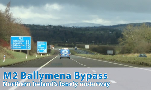
So what's the Ballymena Bypass like?
It's great! Whilst the motorway itself is a little, well, kind of dull actually, it's actually quite fun. It rather feels like the Northern Ireland Roads Service have had better things to worry about since 1969. Yes, there's some relatively modern signage all the way along it, but as at February 2010, they still hadn't bothered with a barrier in the central reservation, and unlike that on the English A329(M), the central reservation is pretty much just normal width, though there is a grassy mound there!
The whole thing just feels a little bit scruffy and unkempt, though there are some rather wonderful "M2 Bypass" signs around the general area.
From its opening until late 2010, the motorway came to a crashing halt at the southern roundabout, with all traffic being sent up the sliproads, whilst the bridges for the connection to the rest of the M2 remained unused underneath the roundabout. These bridges have now been brought into use as the Ballymena Bypass has seen a southwards extension. It would be silly for us to think that maybe the M2 gained an extension - that would be far too sensible. Nope, it's part of the A26.
However, there's still a little bit of interest at the northern end: there's a tiny stub on the northbound side (though oddly there's no equivalent on the southbound side) for the long-cancelled extension to Coleraine to connect in.
Can you show me some photos?
Sure can...
Can I comment on this motorway?
Of course! Contact me and I'll put them here!
Have any other visitors commented?
Not yet, they haven't.