Pathetic Motorways
home
current
former
unbuilt
lost
secretive
unfinished
by region
features
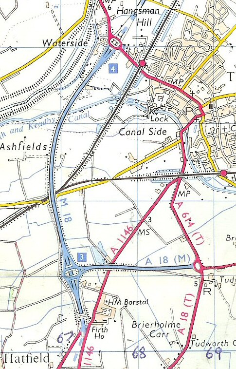
A18(M)
1972 map showing original location of A18(M)
to 1979 map
/
back to A18(M) page
A18(M)
Tudworth Link
County:
Yorkshire
Length:
1 miles
1.6 km
Built:
1972
Status:
Former
Map Links:
Might Have Been Map
Present Day Map
On other websites:
SABRE Files
search PM
powered by
FreeFind
in this section
M10
M15
M41
A18(M)
A36(M)
A40(M) Westway
A41(M)
A46(M)
A102(M) BTSA
A102(M) ECR
A6144(M)