© Tom Sutch - used with grateful thanks. Originally hosted on Apex Corner.
Westway and West Cross Route, London
These two roads were part of the monumental plans for London motorways drawn up by the GLC in the late 1960s (and subsequently dropped in the early 1970s). Along with the East Cross Route (which was once the A102(M)), they are the only parts of the network that were ever built. The Westway was numbered A40(M), and the West Cross Route M41, but in 2000 they were renumbered A40 and A3220 respectively.
Clicking on a thumbnail will take you to the corresponding larger picture.
Westway
 |
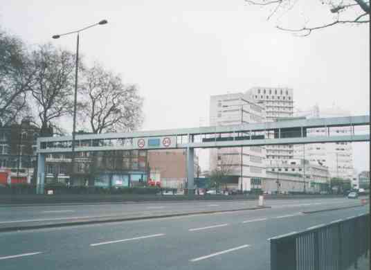
Looking east towards the Marylebone flyover: the eastern end of the Westway bridges the A5 Edgware Road and becomes the A501. There's a plaque on the flyover commemorating its construction and opening -- this is just visible on the centre right of the picture, slightly to the left of the lamppost. |
 |
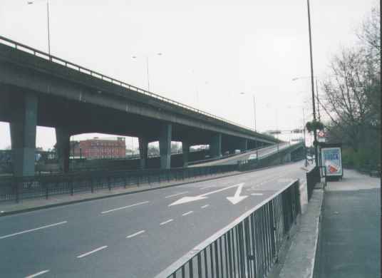
Looking west along the Westway, just after the Marylebone flyover. The Harrow Road (A404) runs on either side of the Westway at this point -- the silver car is actually on the Harrow Road, being separated from the A40 by a raised kerb, and the line of cones. The Westway is at ground level at this point, but not for long: in the background you can see it flying over the roundabout, and it stays at this level until White City. |
 |
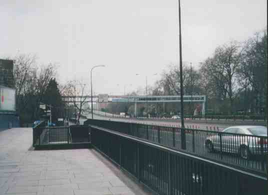
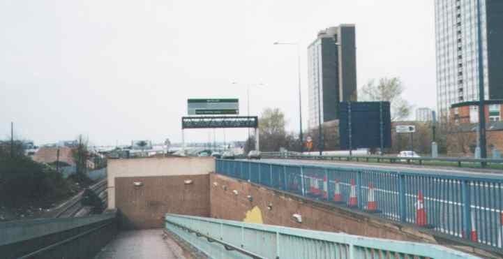
Looking east towards the Marylebone flyover at the junction seen in the previous photo. The merge of the slip road at this junction marked the limits of the motorway classification -- you can see the patched-over blue sign on the gantry which showed the "end of motorway" symbol. The junction design here is very annoying, as you can't get from the A404 westbound to the A40 westbound (although you can get to the A404 from the A40). This means that westbound traffic from the A5 has to trawl through Paddington to get on the Westway. |
 |
The "Paddington slip" (looking westbound). It's always called thus on London traffic reports, never as a junction. Due to the irksome design of the junction with the A404 just west of the Marylebone flyover, traffic wishing to use the A5 must leave the Westway here, and take a detour through Paddington. |
 |
[looking eastbound at the same place] ...if only they'd let exiting traffic (on the slip road in the centre of the picture) join the Harrow Road, (the lower road to the left of the picture), here. Instead, there is a sharp bend (massive chevrons just visible in the centre of the picture) to the right, and the off-slip crosses the railway line and chucks you into Paddington. I think it's either bloody-mindedness on the part of the road's designers, or that the link would not be needed due to other motorway construction (e.g. the North Cross Route) which never happened. |
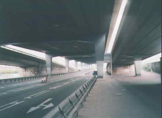 |
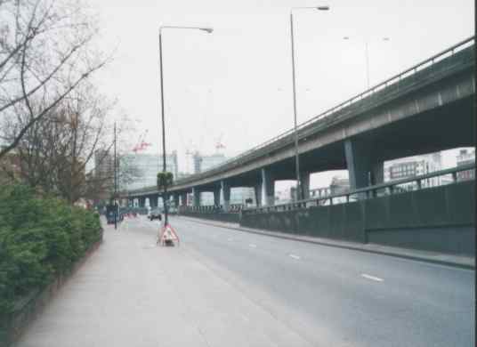
This picture was taken from Royal Oak station, looking eastbound. This is the equivalent junction to the last picture: it is an on-slip to the westbound carriageway (the elevated road at the right of the picture), rather an off-slip from the eastbound carriageway. The A40 (both carriageways) is the wide elevated road that dominates the picture. The westbound carriageway of the A404 Harrow Road runs directly beneath the A40 at this point; you can see it emerging from a short underpass near the centre of the picture. There is also access to the Harrow Road at this point; this is the road which merges with the Harrow Road where the cones are in the foreground. The elevated road to the left of the picture is the eastbound off-slip, as seen in the previous two photos, and the eastbound carriageway of the Harrow Road is hidden behind this. What a cool road layout (it's impossible to decipher various maps' interpretations of the roads here)! |
Westway / West Cross Route junction
|
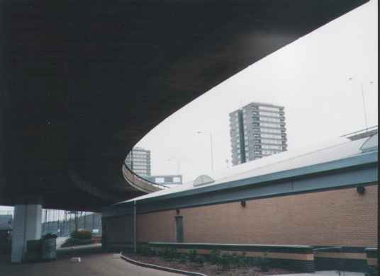
A view of the junction (looking south-east) from underneath -- the high flyover is the A40 Westway. The elevated road dominating the picture is the roundabout that forms the junction. You can just make out the old-style motorway signals -- two orange lights mounted on gantries -- near the middle of the picture. The building in the middle of the roundabout is a relatively recent sports centre. |
|
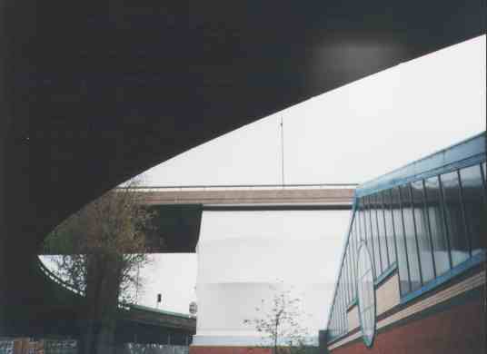
Looking north-west at the junction. The road in the foreground (top left) is the A3220 West Cross Route. This feeds directly onto the roundabout -- the West Cross Route was intended to have an underpass under the roundabout, where the sports centre is now, but it never got built north of here. |
|
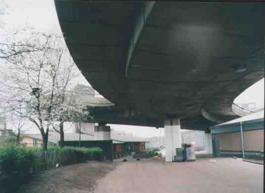
Another view of the junction. The sports centre (including a climbing wall, I believe) is in the foreground -- you can see the roof as you use the roundabout overhead. |
|
The stump of the slip road from the north side of the West Cross Route, pointing threateningly at yet more North Kensington chimney-pots. |
|
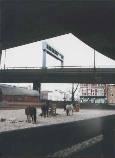
Some strange creatures inhabit this mythical underworld beneath the roundabouts and flyovers... |

West Cross Route
What was the southern extremity of the M41, at the Holland Park roundabout (which has the Thames Water tower in the middle). Notice that pedestrians and cyclists are still not allowed on the road, even though it has lost motorway status. |
|
 |
A new junction (background) has been built on the old M41. Quite impressive seeing as the whole thing's less than a mile long! This new junction will serve the new White City shopping centre / multiplex. Neither the junction nor the development is open yet. Expect lots more traffic on the A3220 when this is opened (groan). Notice the railway to the west of the road -- this was deliberate, and was supposed to minimise the instances of severing communities when building urban motorways, as a barrier already existed. |